What The Tech?! LIDAR

LIDAR would help us to map and navigate the world more effectively.
We’ve made the point before that during times of conflict, technology evolves thanks to the military doing military things. Military needs would give us canned food, radar, portable communications systems and other tools that are instantly recognisable in our modern world.
One of the most prolific areas of development has been in the fields of navigation and scanning. Giving us VHF band radar in the early days, this would continue to evolve into the ultra-modern and very accurate mm-wave radar systems before lasers would enter the mix as well.
This would give us LIDAR (LIght Detection And Ranging). Used for mapping by vehicles on air, sea and land, it plays a key role in the civilian sector and is the star of today’s What the Tech?!. LIDAR is accurate enough to track forrestry and vegetation. Source: Wikipedia.
Concept & Development
Like many developments in the field of electronics, LIDAR was theorised well before functional units were able to be assembled. It would be 1930 when E. H. Synge would theorise detailed search methods by using powerful searchlights to probe the atmosphere. While the theory had merit, it would take until the 1960’s before modern technology would evolve enough to make a functional test unit.
The Hughes Aircraft Company would take the lead here, designing a new system that aimed to use lasers for accurate identification of satellites for tracking purposes. While testing the new design, it was noted that it worked particularly well for obtaining distance measurements as well.
Given the acronym COLIDAR (COherent LIght Detection And Ranging), this early prototype from Hughes would go on to influence early rangefinders, laser altimeters and LIDAR systems that would be based on the COLIDAR design. Drones would also help to evolve the LIDAR revolution. Source: Wikipedia
How it Works
As effective as it is simple, LIDAR works by transmitting in parts of the visible light spectrum. By detecting the return signal and applying some mathematics, LIDAR can then be used for accurate mapping and distance measurement.
While this sounds reasonably simple in theory, it’s worth considering just what this means in context. Given the depth of the visible light spectrum, LIDAR can subsequently use much of this spectrum interchangeably to give the best results for any specific job.
This makes the typical LIDAR unit extremely flexible and capable of operating within a broad spectrum of parameters that enable it to map landscape topography, citiscapes, cloud formations and even vegetation with stunning levels of accuracy.
LIDAR systems can also operate using both Incoherent and Coherent detection depending on the circumstances of their mission. Coherent, which uses direct energy detection, is great for mapping, while Incoherent uses variance in Doppler shift to help with tracking.
Airborne-based LIDAR systems can also use modified beam widths to ensure they are obtaining measurements that are accurate enough to complete their role.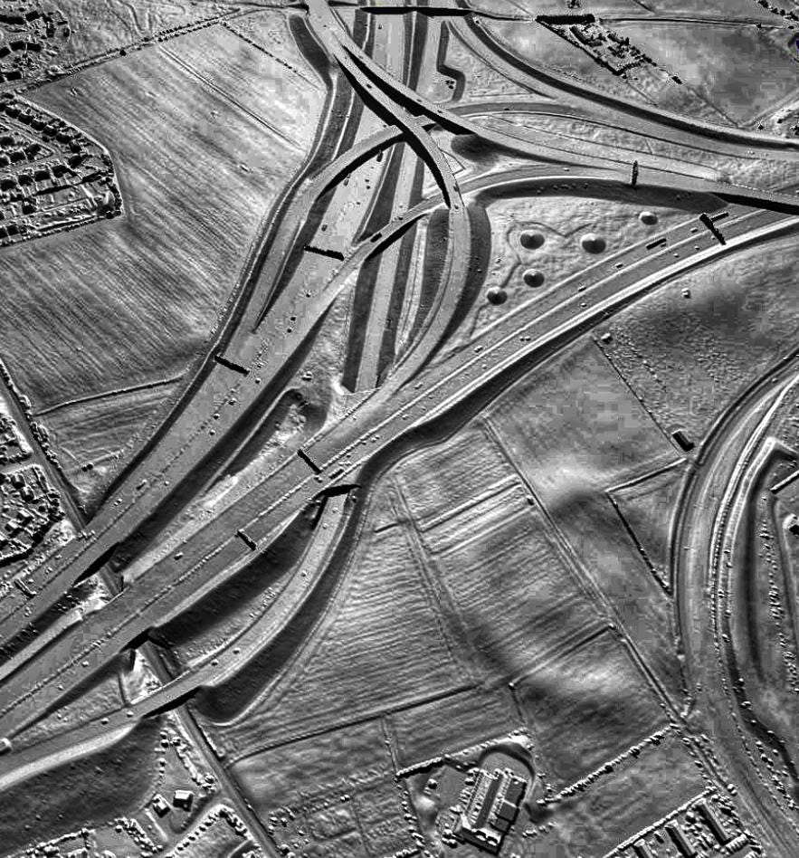 A DSM lidar view of Ferrybridge Henge in West Yorkshire. Source: Wikipedia
Modern Evolutions
While early LIDAR designs would show stunning amounts of potential, it would take a technological shift for them to hit their stride and become relevant to our modern world.
The first would be the development of cutting-edge, solid-state processors that would allow modern LIDAR units to become compact, efficient and more importantly, reliable. Price would also be relevant here, as early LIDAR units that would cost tens of thousands of dollars to develop were eventually able to be produced for cents on the dollar.
The second would be the dramatic steps taken by the US government in the early 2000’s to help spur on the development of autonomous vehicles. DARPA’s Grand Challenge, which would run from 2004 through to 2007, would increase the demand for cheap, reliable LIDAR systems that could be used in automobiles.
This would see an intense period of development that would include drones, cars, and even consumer LIDAR systems, all hitting a market that was hungry for new designs.
Just on the topic of drones, it’s worth pointing out that the aviation industry would be going through a generational shift during this time as well. While aircraft had always been capable of carrying extremely detailed and elaborate payloads for measuring and ranging, new compact LIDAR designs paired with the development of consumer drones now offer the potential to revitalise this industry as well.
Now, surveyors and engineers could complete their work using off-the-shelf drones, reducing the need for aircraft, helicopters and pilots while slashing the overall cost per hour to undertake such work.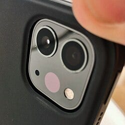 Even the good old iPhone Includes LIDAR now. Source: Wikipedia.
The Future
LIDAR would go through one of the fastest iterations in recent years. What started as an expensive sensor fitted to only the most exotic of hardware is now set to become mainstream. The inclusion of LIDAR on the most modern iPhones helps to highlight this point.
And, despite the iterations seen in the past, modern technology aims to make future LIDAR even more exciting. As always, cost is a huge part of this, but future development should mean that we see.
- LIDAR on a CHIP, making units smaller and standalone.
- AI integration to help develop real-time scene understanding.
- Higher Resolutions for more detailed imaging.
- Longer ranges that help vehicles work more effectively at highway speeds.
- Greater integration with space-based systems for defence purposes.
As we become more reliant on machines to help navigate and move through our modern world, LIDAR is set to play a key role in helping the machines that we build to understand the physical world around us.
While modern artificial intelligence will play a huge role in helping to develop these future ideas into working, functional prototypes, it’s the sensors like LIDAR that are where the real magic happens with regard to bringing them to life.
Investigator515 explores the RF spectrum, cybersecurity, and the hidden tech behind modern espionage.
Follow for new content weekly
Bluesky • X • Substack
You might also like,
History: The Night Stealth Fell: The Story Of Vega-31
Ukraine: Small But Mighty: The TinySA Goes To War
Technology: What The Tech?! Computer-Aided Design