Reaching for the Stars: How Taifa-1 is Propelling Kenya into the Global Space Economy.

For decades, the realm of space exploration and satellite technology was predominantly the playground of a few global superpowers. However, the narrative is rapidly shifting. Africa is experiencing a technological renaissance, and leading this charge on the eastern seaboard is Kenya. On April 15, 2023, Kenya etched its name into the history books with the successful launch of "Taifa-1", the nation’s first operational Earth observation satellite.
This monumental achievement represents much more than a piece of hardware orbiting the Earth. It is a symbol of national pride, a testament to indigenous engineering prowess, and a critical tool for addressing some of the most pressing socio-economic and environmental challenges of our time. In this comprehensive dive, we will explore the genesis of Taifa-1, its cutting-edge technological capabilities, the dramatic journey to its launch, and the profound impact it promises to have on agriculture, disaster management, and Kenya's budding space economy.
The Dawn of Kenya's Space Age
The journey to launching an operational satellite did not happen overnight. It was born out of a strategic vision to harness space technology for national development. The Kenya Space Agency (KSA), working in tandem with the Ministry of Defence, recognized that relying solely on open-source satellite data or purchasing expensive imagery from foreign entities was not a sustainable long-term strategy. Kenya needed its own "eye in the sky" to provide timely, accurate, and customized data.
The overarching goal was clear: to leverage space-derived, data-driven solutions to achieve the country's Sustainable Development Goals (SDGs) and its Vision 2030 objectives. Taifa-1—which translates to "Nation-1" in Swahili—was conceptualized to address chronic local challenges such as food insecurity, the mismanagement of natural resources, and the devastating impacts of climate change. By investing in indigenous space technology, Kenya positioned itself not just as a consumer of global data, but as a sovereign creator of it.
From Blueprint to Orbit: The Making of Taifa-1
The development of Taifa-1 is a compelling story of international collaboration and rigorous capacity building. The project took two years to transition from a conceptual blueprint to a flight-ready spacecraft, backed by an investment of approximately "KSh 50 million" (roughly $372,000 USD).
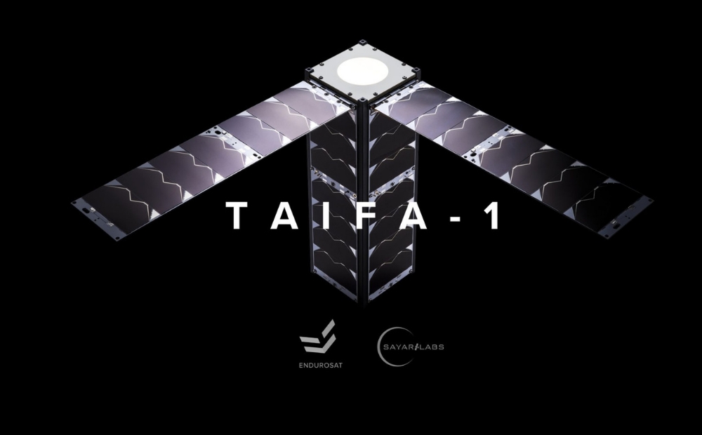
At the heart of this endeavor was a team of nine brilliant Kenyan engineers from SayariLabs. To ensure the satellite met stringent global aerospace standards, SayariLabs partnered with EnduroSat, a renowned Bulgarian aerospace manufacturing company. But this was not merely a procurement contract; it was a deep, symbiotic partnership focused on knowledge transfer.
> "It is also a capacity-building effort for Kenya's engineers in space systems engineering, space operations, ground receiver station operations, mission control, and satellite data acquisition."
> During the two-year development cycle, the Kenyan team underwent intensive, customized training. They mastered the intricacies of the harsh space environment, orbital mechanics, project management, and the full satellite development cycle. While the physical manufacturing took place at EnduroSat’s facilities in Bulgaria, the satellite was fundamentally designed, engineered, and programmed by Kenyans, ensuring that the intellectual property and technical know-how remained firmly within the nation's borders.
Anatomy of a Nanosatellite: Understanding the 3U CubeSat
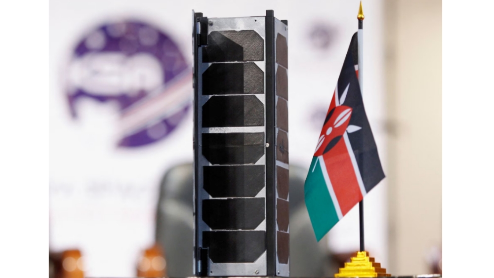
When we think of satellites, we often picture massive, bus-sized structures. Taifa-1, however, belongs to a modern class of spacecraft known as nanosatellites, specifically a "3U CubeSat".
A single "U" (Unit) in CubeSat terminology measures 10 cm x 10 cm x 10 cm. Therefore, a 3U CubeSat like Taifa-1 is approximately the size of a shoebox (10 cm x 10 cm x 30 cm). Despite its compact and lightweight stature, it packs an extraordinary amount of advanced technology.
The architecture of Taifa-1 is divided into four primary segments:
•The Satellite Bus: This is the structural backbone of the spacecraft. It provides essential life-support functions, including power generation (via deployable solar panels), thermal control to survive the extreme temperature fluctuations of space, and communication systems to relay data back to Earth.
•The Payload: The heart of the mission. For Taifa-1, this consists of sophisticated optical imaging equipment.
•The Ground Segment: The infrastructure on Earth responsible for communicating with, commanding, and controlling the satellite.
•The Image Processing Segment: The critical software and hardware systems that translate raw, encrypted space data into actionable, high-resolution imagery.
•Seeing the Unseen: Multispectral and Panchromatic Capabilities
The true value of an Earth observation satellite lies in its payload. Taifa-1 is an optical satellite equipped with a state-of-the-art, high-resolution camera designed to capture the Earth's surface in unprecedented detail. It operates using two primary imaging modes:
1. Panchromatic Imagery (16m Resolution): This mode captures light across a wide spectrum in a single band, essentially producing highly detailed black-and-white images. With a 16-meter spatial resolution, it allows analysts to see fine infrastructural details, city grids, and geographical boundaries.
2. Multispectral Imagery (32m Resolution): This is where the magic of modern agriculture and environmental monitoring happens. Taifa-1 captures data across five different multispectral bands, seamlessly moving between the visible and infrared light spectrums. This low-light and infrared capability is crucial for assessing factors that the naked human eye cannot see, such as the internal moisture content of a plant or the subtle thermal signatures of a nascent wildfire.
Through a technical process called "pan-sharpening", data scientists at the Kenya Space Agency can fuse the 16m high-resolution panchromatic images with the 32m multispectral data. The result is a stunningly clear, high-resolution, multi-band image that provides incredibly rich data for environmental analysis.
The Road to Space: Overcoming Launch Delays
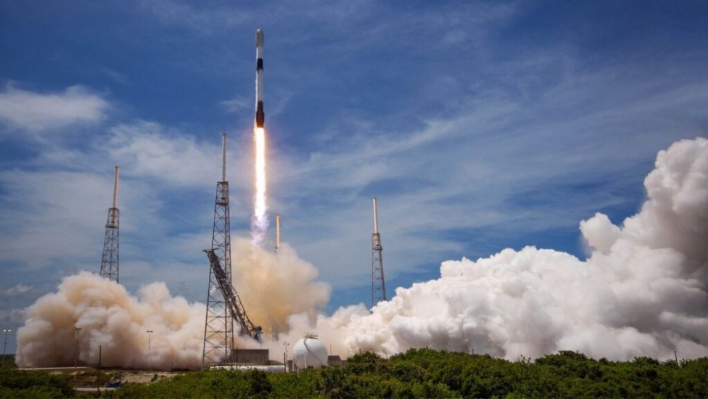
Space exploration is famously unforgiving, and the journey to orbit requires immense patience. Taifa-1's launch was contracted through Exolaunch to fly aboard a "SpaceX Falcon 9 rocket", the world's most reliable and advanced workhorse for orbital missions. The launch site was the historic Vandenberg Space Force Base in California, USA.
The anticipation in Kenya was palpable. The University of Nairobi's Taifa Hall was packed with students, faculty, engineers, and government officials eager to witness history. However, Mother Nature had other plans. The initial launch, scheduled for April 11, was scrubbed due to high upper-level winds and poor weather conditions.
Over the next few days, the launch was delayed three separate times. Spacecraft directors are notoriously cautious—a multi-million dollar payload cannot be risked against adverse atmospheric conditions. Finally, on the morning of "April 15, 2023", the skies cleared. The Falcon 9 engines roared to life, piercing the California atmosphere and successfully deploying Taifa-1 into Low Earth Orbit (LEO). Approximately nine minutes later, the Falcon 9's first stage executed a flawless autonomous landing back on Earth, sealing a perfect mission.
Revolutionary Ground Applications
Now orbiting the globe and flying directly over Kenya every four days, Taifa-1 is actively fulfilling its mission. The data it beams back is not just for academic research; it is actively transforming key sectors of the Kenyan economy.
>Transforming Agriculture and Food Security
Agriculture is the backbone of Kenya's economy, yet it is highly vulnerable to unpredictable weather patterns and resource mismanagement. Taifa-1 acts as an ultimate agricultural diagnostic tool. By analyzing multispectral imagery over time, agronomists can monitor crop health on a granular level.
•Yield Estimation: By assessing the vegetative index of vast farmlands, the government can accurately predict harvest yields, allowing for proactive economic planning.
•Crop Condition Monitoring: The infrared sensors can detect crop stress—such as pest infestations, nutrient deficiencies, or water stress—weeks before the damage becomes visible to farmers on the ground.
•Optimizing Farming Practices: By monitoring how farm inputs (like fertilizers and irrigation) affect different regions over different seasons, agricultural experts can advise farmers on the best practices suited for Kenya’s unique topographical conditions, directly boosting food security.
Mitigating Climate Change and Disasters
Kenya frequently battles natural disasters, notably cyclical droughts in the arid northern regions and devastating floods during heavy rainy seasons.
•Early Warning Systems: Taifa-1’s continuous monitoring provides early warning signals for drought conditions by measuring soil moisture and vegetation depletion.
•Flood Mapping: During heavy rains, the satellite can rapidly map inundated areas, helping emergency response teams direct resources to the most affected communities efficiently.
•Wildfire Management: The satellite's infrared capabilities can spot the thermal signatures of wildfires in dense forests, enabling rapid deployment of firefighting units before the blazes spiral out of control.
Environmental and Urban Planning
Beyond crises, Taifa-1 is a daily tool for sustainable development. It is used for comprehensive natural resource management, tracking the health of Kenya's forests, monitoring the coastline, and observing the water levels of vital lakes and rivers. Furthermore, the high-resolution panchromatic data is invaluable for urban planners mapping the infrastructural development of rapidly expanding cities like Nairobi and Mombasa, ensuring that housing and amenities keep pace with population growth.
•The Ground Segment: Turning Data into Action
A satellite is only as good as the data it delivers and the people who interpret it. The image processing segment back in Kenya is where the raw, binary data transmitted from space is decoded, handled, and archived.
Data scientists and geospatial analysts work tirelessly to process this information. They filter out cloud cover, calibrate the optical sensors, and run complex algorithms to turn the raw data into actionable insights. This newly available proprietary data perfectly complements existing open-source information, giving Kenyan decision-makers a comprehensive, real-time dashboard of the country's environmental and infrastructural health.
•A Stepping Stone: The Future Constellation and Space Economy
Taifa-1 is designed with an operational lifespan of about five years, after which its orbit will naturally begin to decay over a 20-year period until it safely burns up upon re-entering the Earth's atmosphere. However, its legacy will last far longer.
The Kenya Space Agency has made it abundantly clear: Taifa-1 is not a one-off experiment. It is the crucial first stepping stone in a grander vision. Kenya plans to develop a full "constellation of small Earth observation satellites". A constellation will drastically reduce the revisit time—meaning instead of waiting four days for the satellite to pass over Kenya, a network of satellites could provide daily, or even hourly, updates.
Furthermore, the successful deployment of Taifa-1 has catalyzed Kenya's space economy. It has proven that Kenyan engineers can design space-faring hardware. It has sparked interest among STEM students across the country, paving the way for a new generation of aerospace engineers, data analysts, and software developers. The commercial avenues for this data—from selling insights to private agricultural firms to aiding international climate research—are boundless.
Conclusion
The launch of Taifa-1 on that April morning was a watershed moment. It transformed Kenya from a spectator in the global space race into an active participant. By leveraging the vast vantage point of space to solve terrestrial problems, Kenya is ensuring that its future is guided by accurate data, proactive disaster management, and sustainable agricultural practices. Taifa-1 may be a small nanosatellite, but the impact it is hav
ing on the ground is nothing short of astronomical.
Thank You For Reading.