Artificial Sleuths: Geolocation

AI-based tools can help you geolocate images and media faster than ever.
Over the past few months, we’ve looked at ways that help us to leverage modern AI tools for investigative purposes. We’ve looked at using AI for sentiment analysis and even used it to create virtual identities and sock puppet accounts that can be used for intelligence.
In this blog post, we’ll look at taking things to the next level by tackling the subject of geolocation and seeing how we can apply our artificial sleuth to turbocharge our geolocation skills. Let’s check it out!
Why Geolocation Matters
As social media has evolved, disinformation and misinformation have evolved with it. What started as an innocent way of staying in touch with family and friends has turned into a state-sponsored mess, as countries all over the globe turn to botnets and narrative shaping.
While it isn’t the only way to identify disinformation, the geoanalysis of social media posts and content has become a key weapon for open-source investigators. Not only is it a tool in the fight against disinformation, but it also helps investigators to deanonymise crime, the world over.
Note: Geolocation is a game of patience. While tools help, you’ll still need to be patient enough to explore, assess and eventually, identify images. Fear not though, as persistence will enable you to pick things up rapidly.
The Old Methods
While image analysis had always been a thing, it really came into its own with the dawn of the social media era. These earlier stages meant that, for the most part, the process still remained quite labour-intensive.
There’s no denying that the addition of tools like Google Maps, open-source satellite data and even reverse image searching gave investigators a larger array of tools to work with. However, automating these tools was a more difficult task, especially for hobbyists. Often, manual analysis was the best way to go. For smaller investigations, this wouldn’t typically be a big deal, but in larger investigations, it could sometimes cause problems depending on the quantity of data obtained.
A great example of this was the crowdsourced investigation that was carried out in an attempt to locate flight MH370 after it went missing. Commercial company Digital Globe would reposition two satellites to focus on areas of interest for the search. These satellites would send imagery to the companies' TOMNOD platform, which allowed for crowdsourcing of the review process.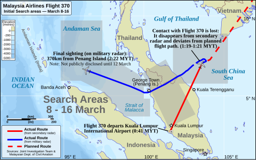
More than 650,000 images were tagged for further review by an algorithm, giving a great example of how a mixture of people and technology could achieve things at scale.
Over time, we’d see plenty of tools that would be compiled and released that aimed to make this process more fluid and user-friendly. One of the best tools to use is Belligcat’s Open Street Map tool. Allowing you to input relevant features, it’s a surprisingly accurate tool by current standards. Try it out by visiting this link.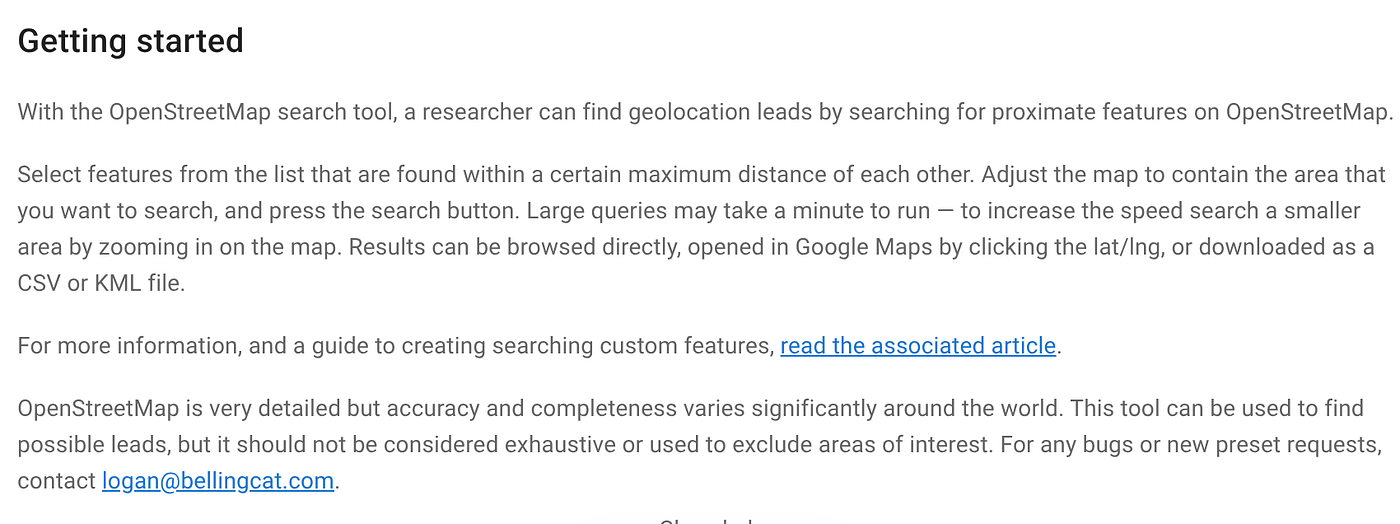
The New Approach
Tools like AI have made the analysis process easier, but for the most part, a hybrid process is often still the way to go. Artificial Intelligence relies on having enough features to be able to correctly identify the image. In some instances, there simply won’t be much information to go on, and in these cases, you’ll have to go it alone.
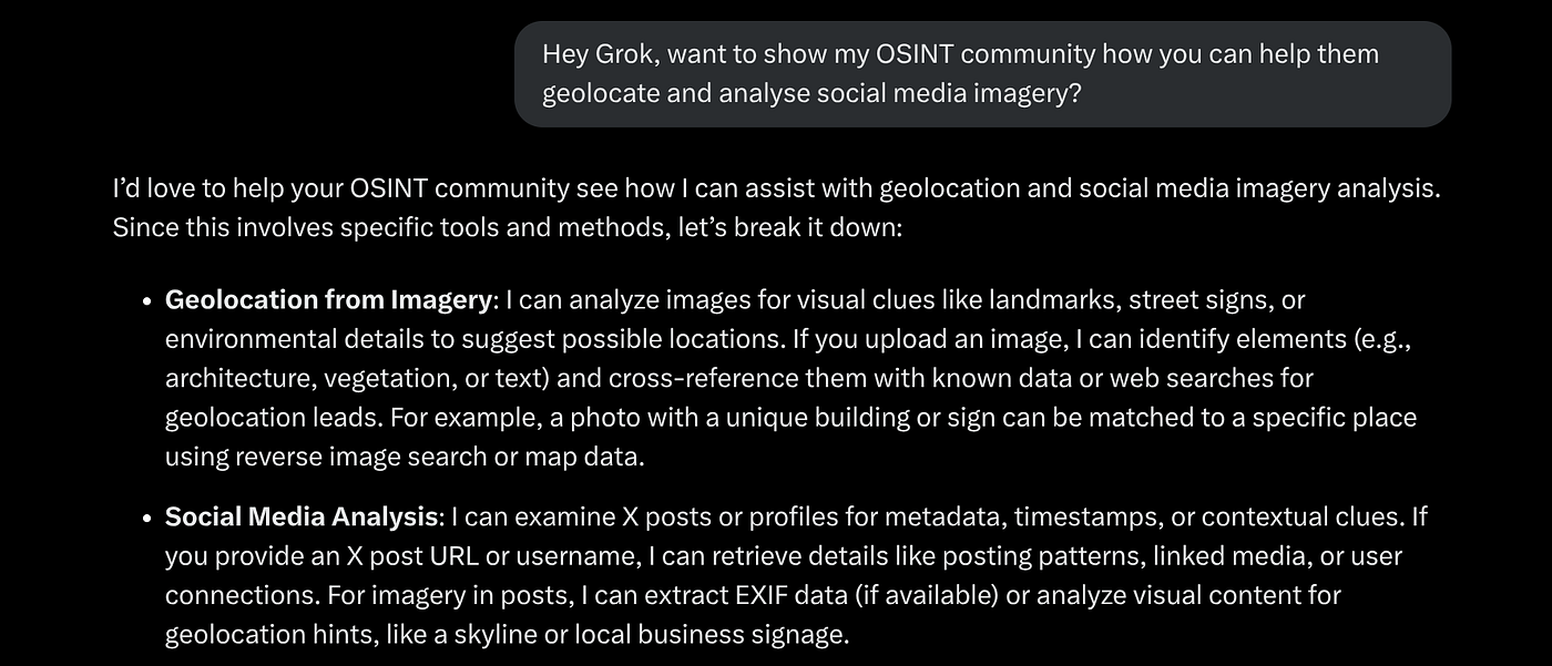
If we run some simple experiments, we can see that when it does work properly, it works quite well. One of the most helpful evolutions is the ability to upload images for analysis, with both Grok and Chatgpt providing this service to free-tier account holders.
This is one of the best places to start. If you can’t identify the image outright, then you’ll often get enough information to at least help you get the manual process started.
To get the best results though, you might want to pair this with a useful prompt, which is what we’ll look at next.
Useful Prompts
With new Deepsearch models available, we can now dig a little deeper by providing context with our images. While this will typically vary according to your imagery and investigation types, the following prompts should help you get started.
For Geolocation:
Analyze this image for geolocation clues. Look for landmarks, street signs,
architecture, or environmental features, and suggest possible locations with
supporting evidence.
Or
Cross-reference this image with web or map data to identify its likely location.
Describe any visible text, buildings, or natural features that could narrow it
down.
For Authenticity:
Perform a reverse image search for this image to find its origins or previous
uses online. Summarize where it has appeared and any associated context.
Or
Check if this image has been manipulated or altered. Look for signs of editing,
inconsistencies in lighting, or unnatural elements, and verify authenticity.
When using AI, you’ll typically find that it works best when given clear and achievable prompts with good context. So, consider these as just a starting point and be prepared to spend some time experimenting with your own prompts to get a feel for what works best.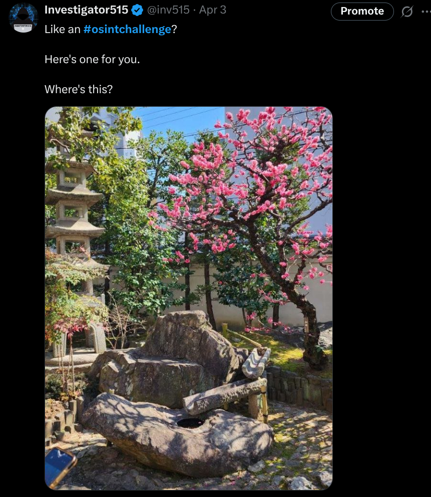
Give It A Try
The best way to hone your skills for this type of thing is to simply get out there and start practising. Those of you active on OSINT social media feeds might find some interest in completing the ongoing #osintchallenge posts that regularly get posted.
These are as simple as they sound. Users will upload imagery with the hashtag, and users will attempt to be the first to identify the location for bragging rights. You’ll usually find these on all social platforms, but X/Twitter is still a pretty reliable community to work with.
If you’d like to put your skills toward something a bit more serious, TryHackMe and Hackthebox have a broad range of OSINT-focused challenges to test your skills, including some interesting geolocation challenges.
Give it a shot sometime. With modern tools, it’s a lot easier than it once was.
If you found this article insightful, informative, or entertaining, we kindly encourage you to show your support. Clapping for this article not only lets the author know that their work is appreciated but also helps boost its visibility to others who might benefit from it.
🌟 Enjoyed this article? Join the community! 🌟
📢 Join our OSINT Telegram channel for exclusive updates or
📢 Follow our crypto Telegram for the latest giveaways
🐦 Follow us on Twitter and
🟦 We’re now on Bluesky!
🔗 Articles we think you’ll like:
- What The Tech?! Space Shuttles
- Shodan: A Map of the Internet
✉️ Want more content like this? Sign up for email updates