Aruba [EN]


Aruba (/əˈruːbə/ ə-ROO-bə, Dutch: [aːˈrubaː] [aːˈrybaː] , Papiamento: [aˈruba]), officially the Country of Aruba (Dutch: Land Aruba; Papiamento: Pais Aruba), is a constituent country within the Kingdom of the Netherlands, situated in the south of the Caribbean Sea. Aruba is located approximately 29 kilometres (18 mi) north of the Venezuelan peninsula of Paraguaná and 80 kilometres (50 mi) northwest of Curaçao.
Aimageruba measures 32 kilometres (20 mi) in length from its northwestern to its southeastern end and is 10 kilometres (6 mi) across at its widest point. Alongside Bonaire and Curaçao, Aruba forms a group referred to as the ABC islands. The Dutch Caribbean encompasses the ABC islands, along with the other three Dutch substantial islands in the Caribbean, the SSS islands. Aruba contributes to about one-third of the population of the Dutch Caribbean.

In 1986, it became a constituent country within the Kingdom of the Netherlands, and acquired the formal name the Country of Aruba.
As one of the four countries in the Kingdom of the Netherlands, alongside the Netherlands, Curaçao, and Sint Maarten, Aruba shares Dutch nationality with its citizens. Aruba lacks administrative subdivisions but is divided into eight regions for census purposes with Oranjestad as its capital.

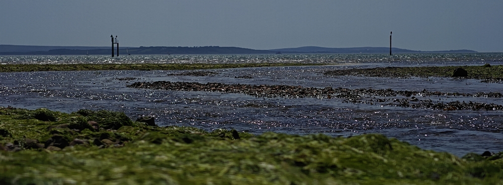
In contrast to much of the Caribbean, which experiences humid tropical climates, Aruba has a dry climate with an arid xeric landscape. The relatively warm and sunny weather persists throughout the year. Aruba has an area of 179 km2 (69.1 sq mi) and a dense population of 108,166 as per the 2020 census.
Etymology
The name Aruba most likely came from the Caquetío Oruba which means "Well situated island", seeing as it was the Caquetío who were present on the island when it was first set foot upon by Alonso de Ojeda. Between 1529 and the signing of the Treaty of Westphalia (1648), the name "Isla de Oruba" was used for the island by the Spanish. After the signing, the island was ceded to the Dutch and gradually its name changed to Aruba.

There were many different names for Aruba used by other Amerindian groups, all of which could have contributed to the present-day name Aruba. Another Caquetío name for the island was Oibubia which means "Guided island". The Taino name for the island was Arubeira. The Kalinago also had two names for the island Ora Oubao which means "Shell island" and Oirubae which means "Companion of Curaçao".
A common misconception is that the name "Aruba" came from Oro hubo, (Spanish for "There was gold once"). However, the Spanish declared these islands islas inútiles, meaning "useless islands", due to their lack of mineral wealth. It was not until, a century later, in 1824, that gold was discovered on Aruba by a twelve-year-old herder named Willem Rasmijn; leading to the Aruban Gold Rush.
History
Pre-ceramic age
In Aruba's prehistoric era, there were distinct periods: the Archaic or Pre-Ceramic and the Neo-Indian or Ceramic (Dabajuroïd) period. The Archaic occupation of Aruba continued well into the first millennium AD, which is relatively late in compared to other parts of the insular Caribbean. The archaic lifestyle revolved around a food economy based on fishing, hunting, and gathering, with a strong emphasis on marine resources. Ceramics were absent, as was horticulture and agriculture. These people not only chipped stones but also polished and sharpened them. Weapons and tools were predominantly crafted from stone. Sharp-edged ax blades, chisels, and knives were commonly used, with the knives distinguishable by their elongated shape and flat blades. One notable site, Sero Muskita, yielded a tool that is older than other archaic age sites on the island. The finishing techniques and shape of this tool resembles one found at Arikok, suggesting a date before approximately 2000 BC. The presence of these tools on the island may be due to occasional visits from the mainland. In total, 33 archaic age sites have been identified on Aruba.
Early human migration and cultural exchange
During this period, the Leeward Islands maintained connections and engaged in trade with mainland South America, particularly with partners in the present-day Falcón-Zulia state in Venezuela and possibly the La Guajira Peninsula (Venezuela/Colombia). The specific language group to which they belonged remains uncertain. This theory is supported by the discovery of 60 to 70 Amerindian cemetery burial grounds in Malmok and Canashito, Aruba. Among these burial sites, five are found smaller Canashito burial ground and are dated between 100 BC to 100 AD. Interestingly, isotopic research revealed that one of the individuals buried there was not from Aruba and had a different diet compared to the other four individuals of Aruban origin. This finding suggests that early human migration and cultural exchange were already part of the cultural pattern of these archaic Indians at an early stage.
Moving forward to a later period, the burial site in Malmok, dates back to the period between 450 and 1000 AD. The Arubans of that time had a short and stocky physique, with adult men averaging 1.57 metres (5.2 ft) in height and women averaging 1.49 metres (4.9 ft). The burial customs offer insight into the social dynamics of the archaic island inhabitants. Based on the burial patterns, it was deduced that they traveled in clans of fifteen to thirty people. These groups were led by an adult man, who was buried at the center of the cluster. His elevated status was emphasized by the presence of several stones marking his grave. The rest of the family group was buried around him.
Neo-Indian period: the Caquetío
The archaic population disappeared from Aruba from the archeological record around 950 AD, shortly after the arrival of the neo-Indian—Caquetío. It is clear that the Caquetíos had a superior culture in socio-economic and technological terms. It is possible that the new Caquetío Indians lived alongside the archaic Indians on Aruba for a time and that they were ultimately displaced or assimilated.
Arrival of the Caquetío
In the year 1500, the Caquetío people lived on Aruba. They belonged to the Arawak people. The origin of Arawak civilization (a name based on a linguistic classification) is located in the central Amazon region. Between 1500 and 500 BC, the influence of the Arawaks had expanded to the Caribbean basin and the Guianas. Between 850 and 1000 AD, Caquetío Indians migrated from western Venezuela, probably from the Paraguaná and Guajire peninsulas, to the Leeward Antilles. They belonged to the Arawak-Maipure language family. The name Caquetío refers to how this group referred to themselves during their first contact with Europeans. They had longer and narrower skulls than the archaic population, and their height was up to 1.60 metres (5.2 ft). The newcomers brought pottery and agriculture to the islands and are therefore classified as part of the neo-Indian period.
Caquetío chiefdom
The area over which the legendary cacique Manaure exercised his authority was the coastal region of the current state Falcón-Zulia at Venezuela, including the Paraguaná peninsula, as well as Aruba, Curaçao and Bonaire. The Caquetío people had a highly developed process of state formation. They had a chiefdom, which in human evolution is often a precursor to a kingdom, where central leaders—paramount chiefs—controlled multiple subordinate political-administrative units. The emphasis was more on the political and religious alliances between indigenous communities than on the military control or subjugate vast territories. At the head of the Caquetío chiefdom was a spiritual leader called diao who had both secular and religious authority in modern terms. He was endowed with powers that could influence nature: a shaman. The diao position was hereditary. By being allowed to marry multiple wives, the diao was able to establish and maintain political alliances with other groups, tribes, or villages. The chiefdom was centralized in its design, but not based on authoritarian or violence-based subjugation. The Spanish conquistador interrupted this process of expansion at the time of the European contact (AD 1499–1535).
Political units and governance
The Caquetío territory consisted of several, and therefore smaller, political units that were under the authority of lower "second-tier chiefs" who were subordinate to the highest authority. How the central authority was exercised over the units is not clear. However, there are reports from the contact period that suggest the diao did not exert his power over the lower units in arbitrary manner. Likely there was a form of consultation between the diao and lower leaders. In the 16th century, two sub-units, the Guaranos and Amuayes, lived on the Paraguaná peninsula. Aruba, which is less than 30 kilometers away from Paraguaná, was previously connected to one of these units.
After the Diao and the regional sub-units, such as the mentioned Guaranaos an Amuayes in Paraguaná, the village formed the third level of governance in the hierarchy of the chiefdom. Aruba had (not simultaneously) five villages: three larger ones Ceri Noca (Santa Cruz), Tanki Flip (Noord), and Savaneta, and two smaller ones near Tanki Leendert and Parkietenbos, which have not yet been systematically studied. The location of Aruban villages varied. They were situated in places where beneficial agriculture land was available and where the most favorable hydrological conditions prevailed, such as where several rooi (gullies) came together and where relatively much water was available.
Agriculture, trade, and network
The Caquetío people probably used a shifting cultivation farming method, also known as slash-and-burn. The yields from agriculture and fishing were supplemented by engaging in trade of raw materials and artifacts that were not locally available or producible. Sixteenth century sources indicate that the Caquetíos traded in, among other things, salt, canoes, tobacco, and beads. The Leeward Caquetíos certainly did not live in isolation, but formed outlying regions of a dynamic chiefdom with regional trading networks.
Burial practices
In 1882, a French explorer named Alphonse L. Pinart, documented an account provided by an old Aruba Indian. According to the Indian's account, witnessed at the former Indian encampment at Saboneta (Savaneta), a native female was inhumed in one of the large conical ollas. Her body was doubled up inside the vase, with the head protruding through the orifice. Subsequently, a smaller urn was placed upside down on the head and the entire burial was covered with earth.
The Caquetío people were buried in clusters, both within and potentially outside village boundaries. At times, there was a secondary burial, possibly reserved for exceptional individuals. In the primary burial, the deceased were buried in a large pot, covered with a smaller pot placed on top. In a secondary burial, the body was initially buried without a pot, and after a few months or years, the bones were exhumed and reburied in smaller pots for a second time. Some pots contained grave offerings such as axes, shells, and pottery. Remarkably, the secondary burial method was practiced until recently in South America. The striking similarity between the Neo-Indian burial practices in Aruba and the post-Columbian variant in Guajira justifies the assumption that the similar beliefs about life after death existed in both societies.
Last indigenous Aruban
Nicolaas Pyclas was regarded as the last known indigenous Aruban. Pyclas spoke and understood the extinct language of the original inhabitants of Aruba, adhering to their way of life and customs. He resided in a hut in Savonet (Savaneta). His diet included sea snails, such as cocolishi (Cerun uva) and carco (Aliger gigas), as well as wild herbs. Pyclas rejected any involvement in religious practices. Around 1840, he was found dead hanging from a tree branch not far from his hut. Estimated to be approximately 50 years old, he was buried in situ and was not properly buried due to the hard rocky surface, he was only covered with a layer of earth and stones. Pyclas skull was gifted to the former Rijks Ethnographisch Museum, presently National Museum of Ethnology in Leiden, with the mediation of A.J. van Koolwijk.
Spanish period
New route to India
It is known that Christopher Columbus was not searching for a new continent, but for the shortest route to India. India had been the spearhead of European trade expansion and the foreign policy of the Spanish Crown since the travels of Marco Polo a century earlier. India, China, and Japan formed the focal point of medieval ideas about boundless riches; cities with houses covered in gold, and islands with inexhaustible amounts of spices, pearls, and silk. The suspicion arose that India could be reached via the relatively short route to the west, across the ocean of Atlantis.
During his third voyage to the New World, Columbus was searching for the southern route to India and explored the Paria Peninsula (Eastern Venezuela) and the Orinoco region, where he discovered the fresh river water of the Orinoco delta. The suspicion arose that he had not found islands off the coast of India but a much more extensive land mass; an extension of Asia. Columbus did not realize that this was an unknown continent. Characteristic of his Christian, medieval attitude, Columbus solved the puzzle by assuming that he had discovered the earthly paradise. The earthly paradise was inaccessible to humans without God's permission. Columbus experienced the geographical discovery of the New World in Christian terms and assigned himself a special role assigned by a divine power. With the discovery of the Americas the myths of the Golden Age, Atlantis, and the earthly paradise moved from Asia to the New World. He died on May 20, 1506, believing that he had found new islands of the coast of or possibly a peninsula of India—pre-islands: Ant-ilha. These Ant-ilhas were inhabited by peoples whom he called "Indians".
Early explorations
In 1500, Juan de la Cosa drew the first map of the New World, which depicted the two Leeward Antilles known at the time. This was followed by the more accurate Cantino map, created anonymously in 1502, which also showed an extensive landmass and mentioned the Isla do gigante (Island of Giants) and Isla do brasil (Island of Brasil). The location of the Isla do gigante southwest of the Isla do brasil suggest that it refers to Bonaire and Curaçao since Aruba is located more to the northwest.
In 1493, the year in which the West Indian islands became known in Europe, the division between the secular (civil) and religious authorities in the New World had to be arranged. The newly appointed Spanish Pope, Alexander VI, issued the Inter Caetera bull, granting the Spanish Crown sovereignty over the newly discovered territories and the responsibility of the holy task: to send good, God-fearing men, who are earned and capable, to those islands and continents to teach the natives living there about the Catholic faith and instill in them good habits. In exchange for the papal approval of the treaty, Spain promised to vigorously carry out missionary work in the discovered territories. This gave Spain the right to evangelize the Americas and appoint and dismiss priests, blurring the separation between church and state in the region. In other words, the Spanish Crown was granted significant religious authority in the Americas, which was not strictly separate from the state and weakened the distinction between the religious and secular spheres—a key aspect of separation between church and state.
The conquistador
Conquistadors were fascinated by legends of inexhaustible gold reserves of El Dorado. The conquest was characterized by bloodshed, destruction, and forced assimilation of the native peoples into European society, such as the initiation of Indian slavery by Columbus in 1492. Europeans had an advantage because they had superior weapons, such as firearms, steel swords, armor, ships, horses, and targeted military strategies. While expedition leaders mostly came from the higher echelons of late medieval society, their foot soldiers were usually from the lower middle class of southern Europe. These soldiers formed the basis of the future group of encomenderos. The encomienda system granted Spanish colonizers right by the Spanish Crown to extract tribute and labor from indigenous peoples. For example, indigenous communities had to give up a portion of the yields from their agricultural or farm land, known as conucos in Taino, as a form of taxation and to provide for the food supply of the colonists. The defeated were often kidnapped and forced to participate in expeditions elsewhere in the New World as slave laborers.
mining on Hispaniola and Puerto Rico declined. Spanish settlers moved elsewhere, and In 1569, the Spanish Crown banned settlement on the Caribbean islands by Royal decree. This measure that did not apply to the leased islands of Curaçao, Aruba, and Bonaire. The colonization of the large Caribbean islands, such as Cuba, was encouraged, while the small islands were abandoned. Most of the islands remained largely uncontrolled and undefended, making them a potential opportunity for northwestern European countries that wanted to break Spain's monopoly on colonizing the New World. England, France, the Netherlands, and Denmark explored the possibilities of piracy and trade on the Caribbean islands.
On the continent, the great empires declined, but indigenous societies continued to exist and were exposed to a long process of miscegenation. In the Falcón-Zulia province, among other places, Caquetío societies survived on Tierra Firme. Although their cultures and social structures were largely destroyed by the Spaniards. On the (former) Caquetío coastal islands of Aruba, Curaçao, and Trinidad, indigenous people lived well into the colonial period. The indigenous history of the Guajira peninsula extends to the present day. The Wayú are increasingly being recognized on the Leeward Antilles as possible contemporary ancestors or lost relatives from (pre)historic times.
Spanish ranch
The conquistadors brought not only people but also European cattle to Aruba. Over time, they also introduced goats, sheep, dogs, donkeys, cows, pigs, and possibly even cats. It's believed that rabbits, brought by the Dutch, later became wild on the island. Aruba essentially became a Spanish ranch, with cattle roaming freely in search of food. Despite more trees in the past, the overall vegetation was similar to today. The horses introduced here were lighter than Dutch ones, and their hooves became so hard from roaming freely that they didn't need horseshoes. To avoid stallions injuring each other during mating battles, horseshoes were impractical. After three weeks of service, particularly in the dry season, the horses were released to recover. Occasionally, a small group of Spaniards would disembark on the island, but typically, Aruba was left to fend for itself. According to De Laet, in 1630, there were "few Indians and some Spaniards" on Aruba.
Early Dutch period
The Dutch were compelled to venture into forbidden waters of the Caribbean, known as Spain's mare clausum, due to their need for salt, in open defiance of Phillip II . Since the mid-15th century, the prosperous Dutch herring industry had been steadily expanding. The West Frisian towns of Hoorn, Enkhuizen, and Medemblik were particularly active in the salt trade, thanks to their thriving fishing industries. Herring was a crucial commodity for Dutch commerce, requiring salt for preservation. Salt also played a vital role in the butter and cheese industry, as well as in preserving food during long voyages. The curing or pickling process for herring was well-established during the Middle Ages. After catching the herring, the packers would remove the internal organs, mix them with salt to create a brine, and pack them in barrels along with additional salt. While Zeeland was not heavily involved in fishing, they were renowned for their salt whitening process, which was highly sought after throughout Europe.
During the 1400s, shipbuilders in the Low countries created a new type of fishing vessel called the herring buss, specifically designed for deep-sea fishing. These busses proved to be significantly more effective than the smaller flat-bottom commonly used for coastal fishing. As time went on and the early 16th century approached, the buss underwent modifications, evolving into three-masted ship with distinctively curved bows.
Salt importation began in the 15th century when the Dutch discovered high-quality salt in Setúbal the Iberian coast. This sea salt was perfect for preserving herring because of its magnesium sulfate and magnesium chloride content. It was also more affordable than domestic salt, which was produced by burning peat from coastal bogs infused with sea salt over the centuries. The Dutch obtained salt from Setúbal by trading goods from the Baltic Sea region. However, the Eighty Years' War, which started in 1585, prompted Phillip II to halt this trade. With the salt supply cut off, the Dutch were forced to seek new trade routes. Their quest for salt led them as far south as the Isla de Mayo and Isla de Sal (the Cape Verde Islands) until 1598, eventually expanding to the West Indies.
Shortages of salt in Cape Verde, combined with unsafe conditions under the Spanish rule, compelled the Dutch to venture across the Atlantic. Seeking alternative sources, they initially explored Brazil but abandoned it due to inadequate saltpans. They then turned their attention to Punta de Araya in Tierra Firme before the 17th century. The salt reserves in Punta de Araya had been largely untouched by the Spaniards, with numerous accessible pans spread along the coast and islands. While the Iberians were primarily attracted to the area for its pearls, the salt in Punta de Araya was abundant and of high quality, surpassing that of the Iberian peninsula. Rather than being a rock salt deposit, it was a gem salt derived from the clay of the surrounding hills. However, following the Truce of twelve years, the Dutch discovered that the Spaniards had fortified the saltpans, forcing them to give up their stake in Araya salt.
After hostilities resumed, the Dutch established the West India Company (WIC) with the main objective of engaging in strategic military actions and privateering organization against Spain. This was the raison d'être or reason for the existence of the WIC. Their secondary objective was focused on commerce and colonization, a choice that ultimately led to the downfall of the WIC in 1674. The WIC also gathered information on Spanish treasure fleets. In 1623, the first official fleet of the new WIC, a small squadron of only three ships commanded by Pieter Schouten, set sail for the Caribbean to engage in looting and plundering in the Lesser Antilles and the Yucátan peninsula. It was during this voyage that the Dutch first encountered Aruba.
The Dutch herring production reached its peak in the seventeenth century, earning it the nickname "gold mine of the republic" by the Dutch government in 1624. Around 1628 or 1629, the Dutch started obtaining salt regularly on Tortuga. Governor Francisco Núñez Melián of Venezuela destroyed the saltpans and took some Dutch prisoners, forced them to cut Brazilwood in Curaçao. One of these Dutchmen, Jan Janszoon Otzen, carefully assessed the island's excellent harbor and profitable saltpans, which he later communicated to the WIC. Recognizing their struggle for salt, the Dutch realized the need to establish a base in these waters to secure Curaçao. Johannes van Walbeeck, a renowned Company agent with a commendable record in Brazil, was appointed as the expedition's commander and future Governor of Curaçao, Bonaire, and Aruba. Curaçao was captured and acquired by the WIC in June 1634, primarily by their desire to obtain salt. In Van Walbeeck's report of 1634, Aruba is mentioned only in relation to Curaçao, where he refers to Bonaire and Aruba collectively as the "islands of Curaçao". Spain had another reason to regret its past neglect of the islas inútiles (usless islands) as they came under control of foreign invaders disputing Spain's arrogant claims. However, the Dutch were dissatisfied with the available salt supply. The natural salt pans were inadequate, and their attempts to create an artificial one at the entrance of Sint Ann Bay were a complete failure. Although the salt pans in Bonaire showed more potential, they never developed into a major salt trading center. In 1816, Aruba possessed seven salt pans, all of which yielded salt of subpar quality. The salt production was just sufficient to meet the local demand. Aruban laborers, often assisted by donkeys, were tasked with gathering the salt, which was subsequently distributed among the island's inhabitants. Around 1924, salt extraction at Rancho had limited benefits, primarily being used in the preservation of fish during shipping. Paardenbaai (Horses' Bay) contained salt pans up until 1949 when it was dredged and disappeared beneath the sand.
1648–1687
Between the Peace of Westphalia in 1648 and the Peace of Nijmegen in 1678, there were 30 years of crisis in the Dutch Antilles and the entire Caribbean region. By 1648, Curaçao had lost its importance as a military outpost. Governor Peter Stuyvesant had a plan to strengthen the connections between the islands and New Netherland. He believed that the two colonies could support each other: New Netherland would provide food in exchange for slaves from Curaçao, horses from Aruba, and salt from Bonaire.
But Stuyvesant didn't anticipate the rivalry between the two colonies, which prevented them from working together effectively. The Dutch in Curaçao preferred to sell their goods to other Caribbean islands where they could get a better price, rather than trading with their fellow countrymen in New Netherland. Additionally, the islands were involved in illegal trade with the Spanish mainland and didn't want to switch to legal trade with New Netherland. Governor Stuyvesant needed slaves to strengthen New Amsterdam's defenses, but he mostly received old or sick slaves, called mancarrons, in response to his requests. The better slaves were sold elsewhere to the highest bidder. However, the people in New Netherland weren't motivated by unselfish reasons or a strong sense of patriotism. They continued to trade with their French, English, and Swedish neighbors across the border. Only in extreme situations did their shared heritage become more important than making money. For example, when the islands faced famine due to a series of dry seasons, Stuyvesant came to the rescue by sending a ship with food just in time.
The troubled relationship between the Curaçao islands and New Netherland came to a sudden end in 1664. At that time, even though a war between England and the United Provinces hadn't been officially declared yet, an English fleet led by Richard Nicolls demanded that New Amsterdam surrender. While the Dutch briefly regained control of the colony in 1673, it was once again used as leverage in 1674 to show the English the dangers of their alliance with France.
During the 17th century, the Dutch considered England their main adversary, as evidenced by the three wars they fought against the English. Unlike the first Anglo-Dutch War (1652–1654), the second Anglo-Dutch war (1665–1667) had a long-lasting impact in the Caribbean.
In the end, the Second Anglo-Dutch War and the subsequent peace treaty in 1667 marked a pivotal moment in Caribbean colonial possessions. Dutch supremacy waned, and the enforcement of English Navigation Acts left a lasting impact on regional trade. Nevertheless, the Caribbean islands eventually regained stability and prosperity, experiencing fewer changes in colonial holdings for centuries to come.
Slavery
In the 16th century, Spaniards engaged in coercive labor practices, deporting Arawak Indians to Hispaniola in 1515. Colonists exerted control over Indians on the "useless islands", mirroring the hardships of these faced by subsequent African slaves, marked by a denial of freedom and forced labor.
After 1775 is when the names of African slaves began appearing in records, with examples such as "Cecilia" and "Apolinar" tied to families like Silvester and Alvarez from Alto Vista near the coast.
The Dutch colonizer recognized red slavery, particularly of Indians captured in wars. In the Guyanas, Indians taken as prisoners in conflicts were traded, even following peace treaties. Though Indians on Aruba weren't officially classified as slaves during the West India Company's rule, oral tradition in Aruba mentioned Amerindian slaves in the early 20th century. Father Paul Brenneker [nl] noted their presence in Curaçao as pseudo-slaves.
In 1827, Commander Simon Plats found 51 Amerindians treated as pseudo-slaves by Aruban families. Some were brought by shipowners involved in the slave trade. Plats had masters sign a declaration recognizing the freedom of the Amerindians, ensuring proper upbringing, education, and accommodation.
Contrary to common belief, Aruba had a history of slavery, challenging the notion that conditions were considerably better than in other Caribbean regions. Records are limited, with mentions primarily concerning Curaçao in 1750 and 1795. Aruba's circumstances surrounding slavery were comparatively less severe, leading to misconceptions that indigenous people were not enslaved. However, by 1862, 15 percent of Aruba's population were slaves, with 27 percent in Bonaire.
A Population Report from 1820 indicates 331 slaves in Aruba—157 indigenous people and 174 of African descent. In 1840, the number increased to 497 slaves, with 269 being indigenous people and 228 of African descent. Approximately, half of Aruba's slaves were of indigenous origin, and the other half were of African descent. Although Dutch law generally prohibited the enslavement of indigenous people, the actual practice varied.
The British Empire took control of the island during the Napoleonic Wars holding it from 1806 to 1816, after which it was returned to Dutch authority in accordance with the Anglo-Dutch Treaty of 1814. Aruba was then integrated into the Colony of Curaçao and Dependencies, along with Bonaire. Throughout the 19th century, the island's economy evolved, centered around gold, phosphate (Aruba Phosphate Company), and the aloe vera industry (Royal Aruba Aloe), However, despite these economic activities, Aruba continued to be a relatively underdeveloped and economically disadvantaged region during this period.